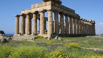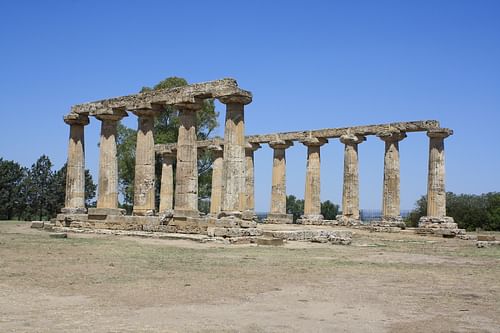
Metapontum, located on the southern coast of Basilicata, Italy, was an Achaean colony founded in the late 8th century BCE. Thriving on agriculture and trade, the city became one of the most prosperous colonies in Magna Graecia. Today, the best surviving evidence of Metapontum's importance in antiquity is the 6th century BCE Temple of Hera with 15 of its Doric columns still standing.
Historical Overview
Foundation
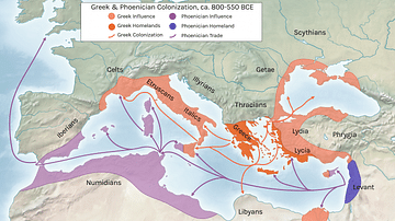
Metapontum (Greek: Metapontion, modern name: Metaponto) is located on a fertile plain which stretches along the southern coastline of the Basilicata region of southern Italy. The city, situated at the mouths of the Bradano and Basento Rivers, was founded by the Achaeans of the Greek Peloponnese c. 720 BCE as part of the wave of Greek colonization from the 8th century BCE onwards across the entire region of southern Italy. Archaeological evidence points to the presence on the site of an earlier Italian town which then displays evidence of Greek culture. A fully-Greek settlement seems to date from c. 630 BCE.
A Thriving City
Metapontum, along with such local rivals as Tarentum (modern Taranto) and Siris (modern Nova Siri), became one of the most prosperous cities in the region which would become known as Magna Graecia. Controlling an extensive area of the lands around the city - some 200 km2 - the success of the colony was largely based on agriculture, fishing and horse-breeding and is attested by the extensive and regular divisions of land in the area with over 850 accompanying small farms which were used over several generations. It is not known if such farmsteads were inhabited all year round or inhabited only during the growing season and then used as storehouses. The average plot of land at Metapontum measures 9 hectares which is larger than the 5 hectares needed to support a single family in the ancient Mediterranean and perhaps indicative of the greater space available in the Greek colonies and so their attraction for emigrants from the homeland.
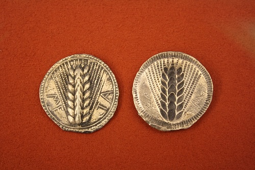
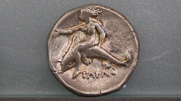
The wealth and trade conducted by Metapontum are further evidenced by the minting of coinage, which was stamped with an ear of wheat in recognition of the city's debt to agriculture, the presence of dedicated areas of workshops, and the numerous dedications made at Panhellenic sites such as Olympia, where the city had a treasury building, and Delphi. The city proper covered around 150 hectares (370 acres) and had several main roads with the largest measuring 22 metres in width. The city was protected by an encircling fortification wall. One notable resident was the philosopher and mathematician Pythagoras (c. 571- c. 497 BCE) who spent the latter part of his life at Metapontum.
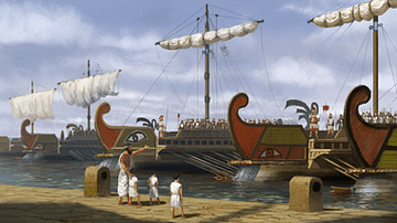
Metapontum would eventually destroy Siris and go on to play an important role in the political and military events of the 5th century BCE, notably supporting the Athenian expeditions against Sicily and on the Italian mainland. According to Thucydides in his Peloponnesian War (7.33.5) they provided 300 darters and two triremes. At the same time, an ominous threat arrived with the founding of a new rival for resources in 433 BCE in the form of Herakleia to the west.
Decline
Metapontum's fortunes declined in the 4th century BCE and the city was defeated by Dionysius I of Syracuse in 390 BCE. The rise of the central Italian tribes also threatened the city's position as a trading centre on the Gulf of Tarentum with the Lucanians attacking and briefly controlling the city in the middle of the same century. Weakened, Metapontum was forced to seek safety in an alliance with longtime rival Tarentum and so became a member of the Italiote League of Greek cities. Metapontum supported the Molossian king Alexander I of Epirus when he attacked Italy and opposed Rome during the Pyrrhic Wars (280-275 BCE). Becoming an ally of Rome shortly afterwards with a Roman castrum or army camp established near the agora, the city nevertheless switched allegiances once again in 212 BCE when Hannibal invaded southern Italy. The city hosted a Carthaginian garrison and provided corn and winter quarters for Hannibal's army, remaining loyal until the general's return to Carthage.
During the 3rd century BCE the city was greatly reduced in size and large parts were abandoned as Metapontum returned to a more agricultural economy with the town leading a quiet existence as a Roman municipium for another century. The city suffered during the Spartacus-led slave rebellion of the 1st century BCE and the demise of its irrigation system meant that the area returned to swamp lands prone to outbreaks of malaria. Metapontum's once fine buildings were abandoned or reused for more modest farm dwellings, a Christian basilica was built in the 3rd century CE and, despite occupation into the 7th century CE, the city disappears from the historical record for two millennia.
Archaeological Remains
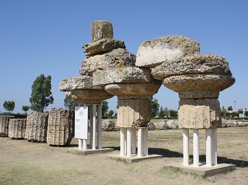
Like much of southern Italy, there are but few traces of Metapontum's great Greek past remaining today. Aside from the lasting legacy of olive and vine cultivation, only one temple still stands as testimony to the city's lost prosperity. The sanctuary of Hera, also known as the Palatine Tables (Tavole Palatine), lies a few kilometres northeast of Metapontum on the road to Taranto (which largely follows the ancient roadway) and boasts the most impressive example of Greek architecture in the region, the Temple of Hera. This 6th century BCE Doric temple once had 6 x 12 columns, 15 of which are still standing.
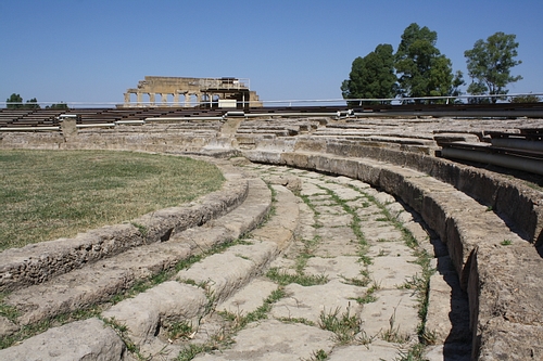
In Metapontum itself there are the remains of the temples and buildings which stood in the central sanctuary complex. The earliest date to 580-570 BCE and included five temples (dedicated to Hera, Athena, Artemis and Apollo) and an ekklesiasterion or assembly place just to the side. A theatre was built over the assembly place in the 5th century BCE which had half columns and a Doric frieze. The theatre was remodelled again in the mid-4th century BCE and in its current form measured 62 metres at its widest part and could seat some 8,000 people.
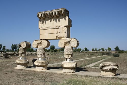
The second major phase of construction was carried out between 570 and 530 BCE which included the erection of the Temple of Hera. This large Doric temple once had 8x17 columns, several drums and capitals of which have been re-erected at the archaeological site today. A third important temple, this time of the Ionic order, was built between 480 and 470 BCE. Dedicated to an unknown deity, it stood on the site of an earlier temple dedicated to Artemis and once had 8x20 columns. Impressive capitals remain in situ which are richly decorated with swirls and swastikas. The building was unlike any in mainland Greece and is further evidence that the colonies of ancient Greece went on their own road of political and artistic development to become fully independent and influential cities in their own right.
