
Illustration
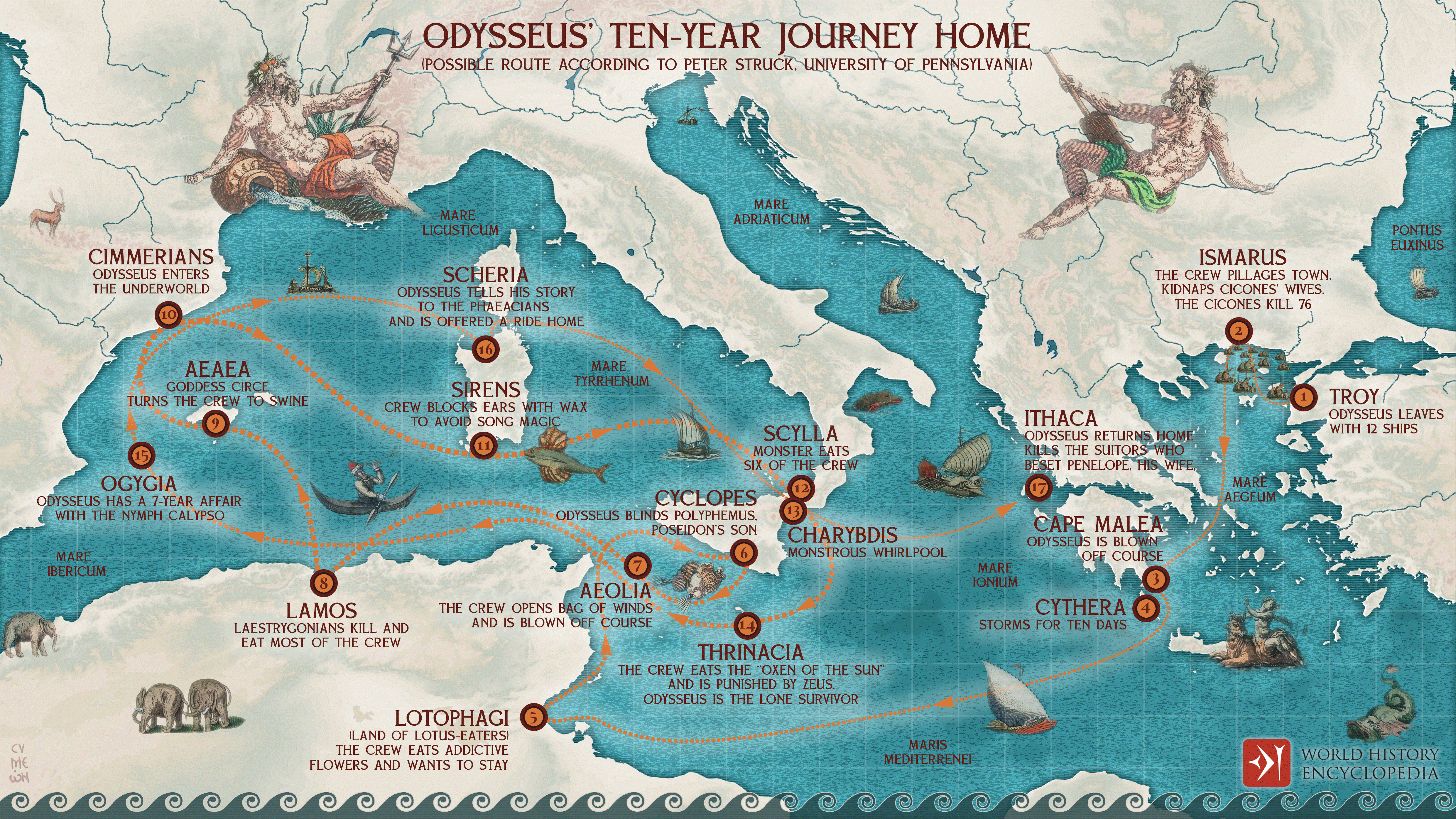
A map illustrating the journey home of the Achaean warrior-king Odysseus after the Trojan war. His travel from Troy to Ithaca (and his wife Penelope) took innumerable twists and turns and lasted ten years. Ever since Homer's Odyssey was written about 600 BCE (and undoubtedly long before that), people have been trying to plot the hero's trek on the Mediterranean map. And for as long, other people have considered this an utterly futile exercise. As far as we know - in 1597, Abraham Ortelius became the first cartographer to set Odysseus' travels on a map. Many trials later (including the prime minister of Britain, William E. Gladstone), we aren't any closer to getting a definitive layout of this epic journey. To illustrate the narrative flow of Hommer's Odyssey, we drew inspiration from the University of Pennsylvania classicist Peter T. Struck's study (2000) of Odyssean geography.
About the Author

Related Images
Odysseus and the Sirens
The Journey of Aeneas from Troy to Rome
Odysseus Blinding the Cyclops
Chain Home Radar Towers

Odysseus and the Sirens (NAM, Athens, 1130)

Standing Taishaku Ten Sculpture
Cite This Work
APA Style
Netchev, S. (2022, May 23). Odysseus’ Ten-year Journey Home. World History Encyclopedia. Retrieved from https://www.worldhistory.org/image/15906/odysseus-ten-year-journey-home/
Chicago Style
Netchev, Simeon. "Odysseus’ Ten-year Journey Home." World History Encyclopedia. Last modified May 23, 2022. https://www.worldhistory.org/image/15906/odysseus-ten-year-journey-home/.
MLA Style
Netchev, Simeon. "Odysseus’ Ten-year Journey Home." World History Encyclopedia. World History Encyclopedia, 23 May 2022. Web. 25 Apr 2024.