
Illustration

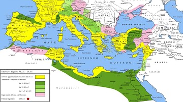
A map illustrating the expansion of the Roman Republic during the wars and conquests of Julius Caesar until his assassination and the transformation into an empire under the reign of Caesar Augustus (also known as Octavian). By 14 CE, the roman world encircled the entire Mediterranean and spanned from the North to the Red sea. It also depicts the administrative division of ancient Rome into various segments, some ruled directly by the Roman emperor and some by the Roman Senate, while others existed in relative autonomy as client states.
About the Author

Related Images
Roman Empire under Augustus

Tang Dynasty Provinces c. 742 CE
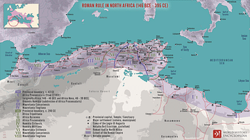
Roman Rule in North Africa (146 BCE to 395 CE)
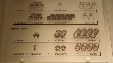
Roman Coin Values Under Augustus
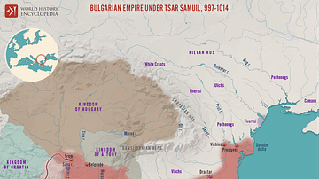
Bulgarian Empire under Tsar Samuil, 997 - 1014
The First French Empire under Napoleon I, 1812
Cite This Work
APA Style
Netchev, S. (2022, March 24). The Provinces of the Roman Empire under Augustus. World History Encyclopedia. Retrieved from https://www.worldhistory.org/image/15518/the-provinces-of-the-roman-empire-under-augustus/
Chicago Style
Netchev, Simeon. "The Provinces of the Roman Empire under Augustus." World History Encyclopedia. Last modified March 24, 2022. https://www.worldhistory.org/image/15518/the-provinces-of-the-roman-empire-under-augustus/.
MLA Style
Netchev, Simeon. "The Provinces of the Roman Empire under Augustus." World History Encyclopedia. World History Encyclopedia, 24 Mar 2022. Web. 16 Apr 2024.